


Just wanted to share some topics which I learned at a Lightroom course yesterday. We, 15 eager aviation photographers, spent the whole day in Rotterdam where we learned a lot of tips and tricks on Adobe Lightroom. Wout de Jong, our course leader, told us all about the structure of LR, importing and exporting pictures, keywording, metadata, editing, droplets, making websites and slideshows. One topic which was new for me was about Geocoding, adding GPS data into your EXIF info. Fun !!!
Well, I can imagine that not everyone is jumping with the same enthusiasm like me, but just read on and see the possibilities this option offers.
Some of you might know that I am a Keywording and Metadata freak. I even added camera data to my scanned slides, so the images in my Lightroom database, which were taken my old Practica, Minolta, or Canon EOS-5 have the correct camera data and of course the data on which the pictures were taken has been correctly filled in, in my Metadata fields.
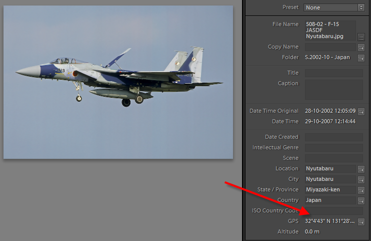
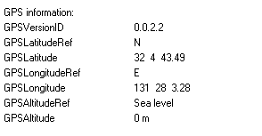
You can imagine that Wout got my full attention when he showed us that Lightroom shows a GPS field with the Metadata options, if the GPS data is taken up in the EXIF Info. So if a picture contains GPS information showing where in the world the picture was taken you will see this:
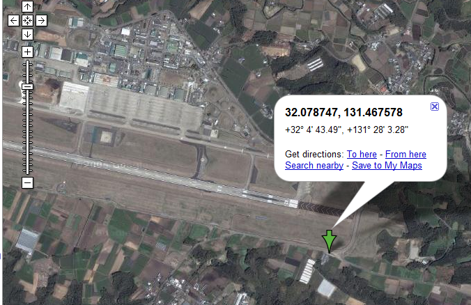
It became even more interesting when he clicked the link. A browser window is opened, and the maps.google.com page is displayed showing the exact location where the picture is taken. Cool !
In the future more and more cameras will be fitted with a GPS receiver which will then enter the location data directly with the picture. Our Canon and Nikon equipment do not have the option yet. It is of course possible to bring a separate GPS receiver with you which will track where you have been the whole time. If you make sure that the clock of your camera and the clock of your GPS are synchronized, you can later merge the GPS log with your Lightroom. You can read more about how you do that works at the Lightroom-news.com website. Check http://lightroom-news.com/index.php?s=GPS
But like you, I still have many pictures which do not have GPS information in them and I would like to add the data in the files as long as it fast and simple. Two remarks about this:
1. Lightroom does not allow us to enter GPS data into the EXIF data of your image yet. The option will probably be added in future versions. There is someone who created a little plug-in for that, but the option is not very stable. Check http://lightroom-news.com/index.php?s=GPS to read more about this.
2. The option to enter GPS information in the EXIF fields of RAW files is available for MAC users, but I haven't found an easy solution for people who work with a PC. With JPG files it easier. With Picasa it quite simple to add the correct information and it is quite fun to work with it. Here a short manual for that.
This works only for JPG files, although you can have some fun tricks with RAW files. What do you need to do
1. Download and Install Picasa from http://picasa.google.com/download/index.html" onclick="window.open(this.href);return false;
2. If do not have it installed yet, Download and Install Google Earth from http://earth.google.com/intl/en/download-earth.html" onclick="window.open(this.href);return false;
3.Load the folder with your pictures which you want to add GPS information to.
4.Select the picture and do; Tools, Geotag, Geotag with Google Earth
5.Google Earth will now start and a Geotag window will popup at the bottom of your screen. Search for the location where you took the picture, place the crosshairs and press the Geotag button. Now the window will move to the next picture and you can search and mark again. It is fairly easy, fast and simple.
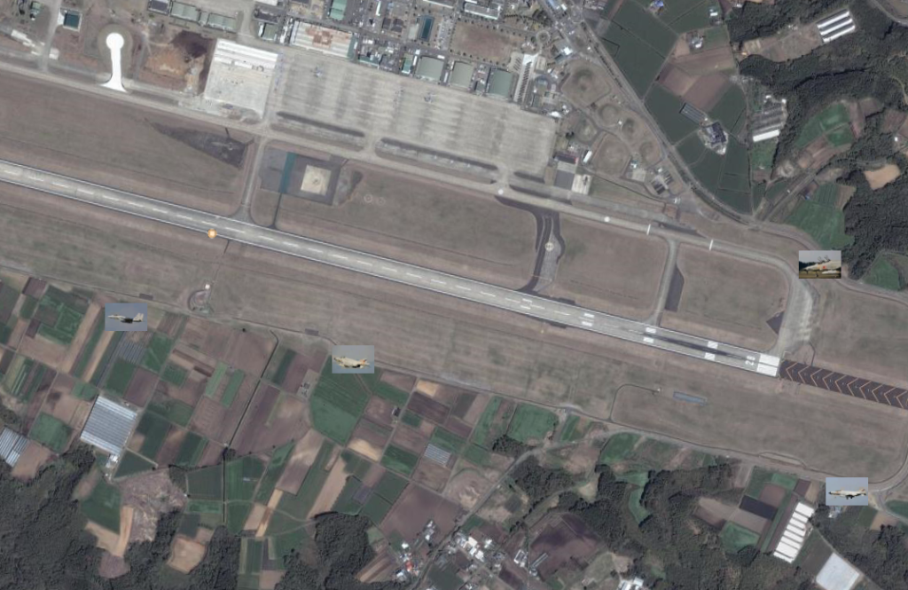
6.A very nice addition to this is that all the pictures will be added to your Google Earth database. So next time you start GE you will see the thumbnails of your pictures which you took all over the world. Fun !
Here an example of Nyutabaru.
I can understand it might be a lot of work for you to add all this information but for a keyword freak like me, who is still busy adding all the serials, aircraft types, operators, locations etc to his Lightroom database, and has a great time doing it, it is just to much fun to stop with it.
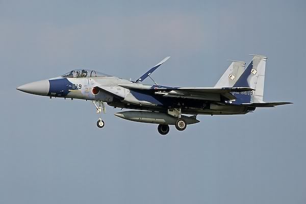
If you add the following picture to your lightroom then you can test the GPS option
Here an example how GPS info is added to your EXIF info
If you also are just as enthusiastic like me, then let me know !


