This is a subscription only section
Want to read more? It's only €10/year.
No account yet? Just Create an account first and head to the shop
| ICAO Code | KCNW/CNW |
| Last Validated | 02-2024 |
| City | Waco |
| Position | 31°38'16"N 097°04'27"W |
| Runway(s) | 17L/35R, 17R/35L |
| Elevation | 470 ft |
TSTC (Texas State Technical College) Waco Airport lies north of Waco city along Interstate 35/US Route 77 between Dallas and San Antonio. Before 1968, it was known as James Connally Air Force Base, used as a pilot training base under the Air Training Command. Nowadays, apart from the College, L3Harris (a merger of the former L-3 Technologies and the Harris Corporation) has its Waco Integration and Modification Center here, a major refurbishment centre for the EP-3, (E)C-130 and C-5.
The airport has two parallel runways, from north to south. West of them is large apron with mainly corporate-style aircraft (used by the TSTC) on its northern part and heavy military hardware on the rest of it. The latter is also the case for L3Harris' apron in the southeastern corner of the field.
The airport, not to be confused with Waco/Regional some miles to the west, and adjacent campus lie along the I35/US77 just north of the city. When coming from the north on the highway, take exit 342A to FM2417, Crest Drive. Turn left onto East Crest Drive to head just north of the main apron and make your way to the desired spot(s) from there on. Alternatively, continue past Crest Drive on the I35 Frontage Road and turn left to cross under the highway at the next option, East Craven Avenue. This leads to the southern part of the main apron (possibly with a little detour due to roadworks). From the south, take highway exit 341 to (East) Craven Avenue and turn onto it to continue as above.

At Waco, you can expect some surprises, like this Hercules now flying with the Polish Air Force. This shot was made from Aviation Parkway, close to spot 5, by Reinold Kalsbeek.
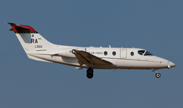
Many trainers use Waco for some approaches, like this one, also captured from spot 5 by Reinold Kalsbeek.
| 121.700 | Ground |
| 124.000 / 255.700 | Tower |
| 126.125 / 227.125 | Departure |
| 127.650 / 227.125 | Approach |
| 124.000 | CTAF |
| L3Harris | various types |
| Arlington MAP | |
| Austin-Bergstrom IAP | |
| Corpus Christi-Cabaniss Field NOLF | |
| Corpus Christi-Waldron Field NOLF | |
| Dyess AFB | |
| Fort Worth - Alliance | |
| Fort Worth - Sycamore Strip | |
| Fort Worth Meacham IAP | |
| Fort Worth NAS - JRB Carswell Field | |
| Houston-Ellington Field | |
| Lackland AFB & Kelly Field | |
| Martindale AHP | |
| Orange Grove NOLF | |
| Randolph AFB | |
| Sheppard AFB - Wichita Falls MAP | |
| TSTC Waco |
As a member you get access to all our
premium content and benefits learn more